DE-1221799 372 - ая открытка

Country: Germany

Distance: 1,074 km

Travel time:  3 days

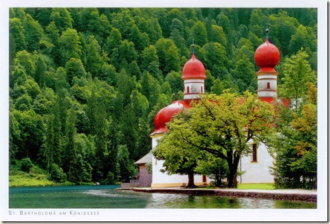
On postcard: St. Bartholomew's Church, Berchtesgaden

St. Bartholomä is a Catholic pilgrimage church in the Berchtesgadener Land district of Bavaria in Germany. It named for Saint Bartholomew the Apostle (Bartholomäus in German), patron of alpine farmers and dairymen. The church is located at the western shore of the Königssee lake, on the Hirschau peninsula. It can only be reached by ship or after a long hike across the surrounding mountains.

A first chapel at the lake was built in 1134 by the Provosts of Berchtesgaden. From 1697 onwards it has been rebuilt in a Baroque style with a floor plan modelled on Salzburg Cathedral, two onion domes and a red domed roof. The church features stucco work by the Salzburg artist Joseph Schmidt and a three-apse quire. The altars in the apses are consecrated to Saint Bartholomew, Saint Catherine, and Saint James respectively.

An annual pilgrimage to St. Bartholomä is held on Saturday after August 24, starting from the Austrian municipality of Maria Alm and crossing the Berchtesgaden Alps.

Near the chapel lies the old hunting lodge of the same name. The lodge, which was first erected in the 12th century with the church, has been rebuilt multiple times. Until 1803, it was a private residence of the Berchtesgaden Prince-provosts; after their territory had been incorporated into the Kingdom of Bavaria in 1810, the building became a favorite hunting lodge of the ruling House of Wittelsbach; today it is an inn.

segodnja

segodnja2

NL-1004739 371 - ая открытка

Country: Netherlands

Distance: 1,082 km

Travel time:  4 days

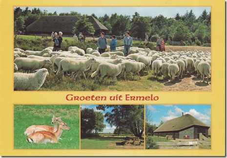
On postcard: Ermelo

Ermelo (Dutch Low Saxon: Armelo or Armel) is a municipality and a town in the Netherlands, in the province of Gelderland in the Veluwe area with a population of over 26.000.

Etymology

Ermelo comes from "lo" woods and "irmin" for which several explanations are given. Some of those are "great",  "divine" or it refers to an old Germanic god called Irmin.

History

The town has been known to exist since at least 855, when the name Irminlo first appeared in a legal document. Human presence in the area goes back further however, with many archaeological finds of the Bell-Beaker culture having been made in the area.

For a long time the town most likely consisted of little more than a few farms and some other buildings like a windmill and a church and it didn't really grow much until the 19th century; in the year 1830 a road was made to make this part of the Veluwe more accessible and at the end of the 19th century the town got a train station. Because the trainstation was some distance away from the town centre a road was constructed, the Stationsstraat, which is now considered to be the centre of the town. After the second world war a shortage of houses resulted in a rapid growth of Ermelo. In 1973 Nunspeet became its own separate municipality after having been part of Ermelo before. In 2005, Ermelo celebrated its 1150 year long existence. Various artists from across the country performed during the festivities. A classic windmill dating from 1863 located in the town centre, named De Koe (The Cow), partially burned down in 1990 after having been hit by lightning, but was restored to working order in late 2008. A nightclub moved out due to the complete renovation.

Recreation

There are many campsites in the forests surrounding Ermelo which are popular place to stay for mainly Dutch and German tourists. Cycling through the forests and heaths is a popular activity, especially during the summer. The nearby Veluwemeer allows for recreation on the water or beach. The town centre is home to various bars and restaurants and a tourist information centre.

Ermelo hosts various music festivals, such as the Fête de la Musique, Multipop and the International Boogie Woogie Festival. In 2010 the latter featured amongst others pianist Little Willie Littlefield and saxophonist Big Jay McNeely.

Transportation

See also: Ermelo railway station

The town's railway station is located near the town centre, with a train normally leaving every 30 minutes during the day both north towards Zwolle and south towards Amersfoort and Utrecht. By car, it can be easily reached from highway A28 which passes west of the town and provincial road N303 which passes through the town. There are also various bus routes passing through the town. Horst is easily accessible from the A28. A pedestrian and cyclist only ferry operates between Horst beach and Zeewolde, crossing the Veluwemeer.

Sports

Ermelo is home to various sports clubs. At the time of UEFA Euro 2000, the Portuguese national team stayed in Ermelo and played against one of the local clubs, DVS '33. This club organizes an annual international tournament for young players. Spanish La Liga football team Valencia CF has regularly used Ermelo as a base for their preseason training, and have played a number of matches at the local ground against other visiting clubs from Europe, such as Lokomotiv Sofia in 2007 and Fenerbahçe in 2006. In May 2009 it became clear that plans for a merge of DVS '33, EFC '58 and KC Ermelo were cancelled.

Image0012

Image0013

NL-1004467 370 - ая открытка

Country: Netherlands

Distance: 1,099 km

Travel time:  4 days

Image0014

Image0037

UA-200395 369 - ая открытка

Country: Ukraine

Distance: 682 km

Travel time:  8 days

Image0009

Image0010

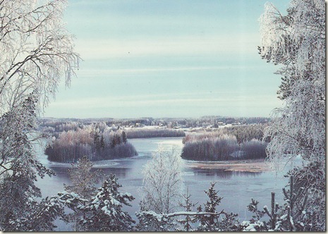
FI-1312711 368 - ая открытка

Country: Finland

Distance: 724 km

Travel time:  4 days

Image0093

Image0094

PL-349332 367 - ая открытка

Country: Poland

Distance: 559 km

Travel time:  5 days

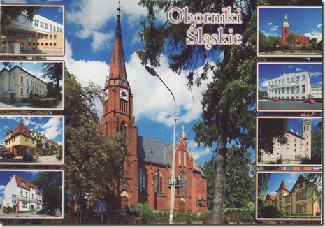
On postcard: Oborniki Śląskie

Oborniki Śląskie [ɔbɔrˈniki ˈɕlɔ̃skʲɛ] (German: Obernigk) is a town in southwestern Poland. It is located in the northeastern part of the Lower Silesian Voivodeship and is part of Trzebnica County. It is the seat of the administrative district (gmina) called Gmina Oborniki Śląskie.

The town became a resort and spa in the 1830s while part of the Kingdom of Prussia.

The town lies approximately 12 kilometres (7 mi) west of Trzebnica, and 22 kilometres (14 mi) north-west of the regional capital Wrocław. As at 2006 it has a population of 8,426.

Etymology

One theory of the town's name is that it derives from Obora (Polish for "cow-shed"), denoting a village whose people were engaged in cattle-breeding. Another theory suggests it derives from O bor, meaning forest, indicating it was taken from pine and fir forests that were growing on loess deposited land. However, the town is surrounded by oak trees, not by pine or fir. The town's name remained largely unchanged through its history, including variations like Obora, Obornik, Obiring, Obernigk. The suffix Śląskie ("Silesian") was added after 1945 to differentiate the town from Oborniki in Greater Poland Voivodeship.

History

The earliest known human traces in this area comes from the Mesolithic Kurgans characteristic for early Bronze Age Lusatian culture have been found nearby, as well as artifacts such as Mesolithic flint tools and Neolithic axes.

Oborniki was first documented in a note calling for Obora to pay a tithe to the Bishopric of Wrocław in 1305. Cistercians once lived near the town, which was based on Magdeburg rights, although it did not actually have the status of a town. In the early 14th century, the town was transferred from the Bishops of Wrocław to Duke Konrad I of Oels (Oleśnica).

Along with the rest of Silesia, Oborniki came under the sovereignty of the Kingdom of Bohemia, part of the Holy Roman Empire, during the Late Middle Ages. The region was inherited by the Habsburg Monarchy of Austria in 1526 and taken by the Kingdom of Prussia in 1742 during the Silesian Wars. It was administered in the Prussian Province of Silesia as Obernigk.

Karl Eduard von Holtei lived in Obernigk for a few years and married Luise Rogée there in 1821. He described the town in his poems. Because of its good climate in the Katzengebirge (Trzebnickie Hills), Obernigk began to develop from a provincial village into the spa Bad Obernigk under the guidance of the landowner Carl Wolfgang Schaubert in 1835.

In 1856 the town was located along the railway line between Breslau (Wrocław) and Posen (Poznań). When cholera broke out in Breslau in 1866, many inhabitants fled to Obernigk. The town became part of the Prussian-led German Empire in 1871.

Until the end of World War II, Bad Obernigk was part of Landkreis Trebnitz in the Province of Lower Silesia, Germany. Because of its spas and sanatoriums, it was popular with the citizens of Breslau and other cities in Lower Silesia.

The town was transferred from Germany to Poland in 1945 and had its remaining German-speaking population expelled; it received town privileges in the same year.

Flag and Coat of Arms

The flag of the city was approved by the Heraldic Commission, and has been the official emblem of Oborniki Śląskie since June 2002.

The flag presents the city's coat-of-arms on a green and yellow background. The coat-of-arms of the city is a green fir with a brown trunk, a symbol referring to the historic character of the town during World War II, on a yellow background.

Image0091

Image0092

US-1484058 366 - ая открытка

Country: USA

Distance: 7,196 km

Travel time:  14 days

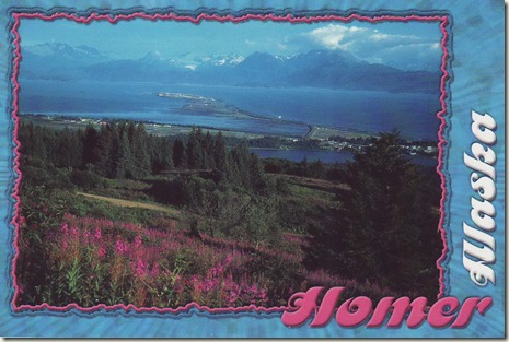
On postcard: Homer

Homer is a city located in Kenai Peninsula Borough in the U.S. state of Alaska. According to 2005 Census Bureau estimates, the population was 5,364. One of Homer's nicknames is "the cosmic hamlet by the sea"; another is "the end of the road". A popular local bumper sticker characterizes the town as "Homer - A quaint little drinking village with a fishing problem."

Image0055

Image0056

Wishing you a Merry Christmas!

Image0087

Image0088

С Новым годом!

Image0085

Image0086

DE-1208661 365 - ая открытка

Country: Germany

Distance: 1,052 km

Travel time:  7 days

Image0089

Image0090

NL-989007 364 - ая открытка

Country: Netherlands

Distance: 1,154 km

Travel time:  7 days

Image0057

Image0058

DE-1200207 363 - ая открытка

Country: Germany

Distance: 572 km

Travel time:  13 days

Image0072

Image0082

BY-331889 362 - ая открытка

Country: Belarus

Distance: 458 km

Travel time:  7 days

Image0083

Image0084

NL-934774 361 - ая открытка

Country: Netherlands

Distance: 1,001 km

Travel time:  38 days

Image0053

Image0054

RU-719217 360 - ая открытка

Country: Russia

Distance: 719 km

Travel time:  24 days

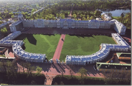
On postcard: Catherine Palace

The Catherine Palace (Russian: Екатерининский дворец) was the Rococo summer residence of the Russian tsars, located in the town of Tsarskoye Selo (Pushkin), 25 km south-east of St. Petersburg, Russia.

History

The residence originated in 1717, when Catherine I of Russia engaged the German architect Johann-Friedrich Braunstein to construct a summer palace for her pleasure. In 1733, Empress Anna commissioned Mikhail Zemtsov and Andrei Kvasov to expand the Catherine Palace. Empress Elizabeth, however, found her mother's residence outdated and incommodious and in May 1752 asked her court architect Bartolomeo Rastrelli to demolish the old structure and replace it with a much grander edifice in a flamboyant Rococo style. Construction lasted for four years and on 30 July 1756 the architect presented the brand-new 325-meter-long palace to the Empress, her dazed courtiers and stupefied foreign ambassadors.

During Elizabeth's lifetime, the palace was famed for its obscenely lavish exterior. More than 100 kilograms of gold were used to gild the sophisticated stucco façade and numerous statues erected on the roof. It was even rumoured that the palace's roof was constructed entirely of gold. In front of the palace a great formal garden was laid out. It centres on the azure-and-white Hermitage Pavilion near the lake, designed by Zemtsov in 1744, overhauled by Rastrelli in 1749 and formerly crowned by a grand gilded sculpture representing The Rape of Persephone. The interior of the pavilion featured dining tables with dumbwaiter mechanisms. The grand entrance to the palace is flanked by two massive "circumferences", also in the Rococo style. A delicate iron-cast grille separates the complex from the town of Tsarskoe Selo.

Although the palace is popularly associated with Catherine the Great, she actually regarded its "whipped cream" architecture as old-fashioned. When she ascended the throne, a number of statues in the park were being covered with gold, in accordance with the last wish of Empress Elizabeth, yet the new monarch had all the works suspended upon being informed about the expense. In her memoirs she censured the reckless extravagance of her predecessor:

"The palace was then being built, but it was the work of Penelope: what was done today, was destroyed tomorrow. That house has been pulled down six times to the foundation, then built up again till it was brought to its present state. The sum of a million six hundred thousand rubles was spent on the construction. Accounts exist to prove it; but besides this sum the Empress spent much money out of her own pocket on it, without ever counting".

In order to gratify her passion for antique and Neoclassical art, Catherine employed the Scottish architect Charles Cameron who not only refurbished the interior of one wing in the Neo-Palladian style then in vogue, but also constructed the personal apartments of the Empress, a rather modest Greek Revival structure known as the Agate Rooms and situated to the left from the grand palace. Noted for their elaborate jasper decor, the rooms were designed so as to be connected to the Hanging Gardens, the Cold Baths, and the Cameron Gallery (still housing a collection of bronze statuary) - three Neoclassical edifices constructed to Cameron's designs. According to Catherine's wishes, many remarkable structures were erected for her amusement in the Catherine Park. These include the Dutch Admiralty, Creaking Pagoda, Chesme Column, Rumyantsev Obelisk, and Marble Bridge.

Upon Catherine's death in 1796, the palace was abandoned in favour of the Pavlovsk Palace. Subsequent monarchs preferred to reside in the nearby Alexander Palace and, with only two exceptions, refrained from making new additions to the Catherine Palace, regarding it as a splendid monument to Elizabeth's wealth and Catherine II's glory. In 1817, Alexander I engaged Vasily Stasov to refurbish some interiors of his grandmother's residence in the Empire style. Twenty years later, the magnificent Stasov Staircase was constructed to replace the old circular staircase leading to the Palace Chapel. Unfortunately, most of Stasov's interiors - specifically those dating from the reign of Nicholas I - have not been restored after the destruction caused by the Germans during World War Two.

When the German forces retreated after the siege of Leningrad, they had the residence intentionally destroyed, leaving only the hollow shell of the palace behind. Prior to World War II, the Russian archivists managed to document a fair amount of the contents, which proved of great importance in reconstructing the palace. Although the largest part of the reconstruction was completed in time for the Tercentenary of St Petersburg in 2003, much work is still required to restore the palace to its former glory. In order to attract funds, the administration of the palace has leased the Grand Hall to such high-profile events as Elton John's concert for the elite audience in 2001 and the 2005 exclusive party which featured the likes of Bill Clinton, Tina Turner, Whitney Houston, Naomi Campbell, and Sting.

In Twentieth Century Fox's 1997 animated feature, "Anastasia", the Catherine Palace is depicted inaccurately as the home of the last imperial family.

Layout

Although Stasov's and Cameron's Neoclassical interiors are superb manifestations of the late 18th-century and early 19th-century taste, the palace is best known for Rastrelli's grand suit of formal rooms known as the Golden Enfilade. It starts at the spacious airy ballroom, the "Grand Hall" or the "Hall of Lights", with a spectacular painted ceiling, and comprises numerous distinctively decorated smaller rooms, including the reproduced Amber Room.

The Great Hall, or the Light Gallery as it was called in the 18th century, is a formal apartment in the Russian baroque style designed by Bartolomeo Rastrelli between 1752 and 1756. The Great Hall was intended for more important receptions such as balls, formal dinners, and masquerades. The hall was painted in two colors and covers an area of approximately 1,000 square meters. Occupying the entire width of the palace, the windows on the eastern side look out onto the park while the windows of the western side look out to the palace plaza. In the evening, 696 lamps are lit on 12-15 chandeliers located near the mirrors. The halls sculptural and gilded carvings and ornimantation were created according to sketches by Rastrelli and models by Johann Franz Dunker.

Beyond the Great Hall is the dining room for the courtiers in attendance (the Courtiers-in-Attendance Dining Room). The room was designed by Rastrelli in the mid-18th century. The small room is lit by four windows which look out into the formal courtyard. The architect placed false windows with mirrors and mirrored glass on the opposite wall, making the hall more spacious and bright. Decorated in the typical baroque interior style, the hall is filled with gilded wall-carvings, complex gilded pieces on the doors, and ornamental patterns of stylized flowers. The ceiling mural was painted by a well known student of the Russian School from the mid-18th century. It is based on the Greek myth of the sun god Helios and the goddess of the dawn, Eos.

Across from the Courtiers-in-Attendance Dining Room, on the other side of the Main Staircase, is the White Formal Dining Room. The hall was used for the empresses' formal dinners or "evening meals". The walls of the dining hall were decorated with the utmost extravagance with gilded carvings. The furnishings consist of gilded carvings on the consoles. The painted mural, The Triumph of Apollo is a copy of a painting completed in the 16th century by Italian artist, Guido Reni.

The Portrait Hall is a formal apartment that covers 100 square meters of space. The room's walls boast large formal portraits of Empress Catherine I, Empress Elizabeth Petrovna, as well as paintings of Natalya Alexeyevna, sister of Peter the Great, and Empress Catherine II. The inlaid floors of the hall contain precious woods. The Drawing Room of Alexander I was designed between 1752 and 1756 and belonged to the Emperor's private suite. The drawing room stood out from the rest of the formal rooms in the palace due to the fact that the walls were covered in Chinese silk. Other decor in the room was typical for the palace's formal rooms, a ceiling mural, gilded carvings. The elegant card-tables and inlaid wood commode display Japanese, Chinese, and Berlin porcelain.

The Green Dining Room, which replaced Rastrelli's "Hanging Garden" in 1773, is the first of the rooms in the northern wing of the Catherine Palace, designed by Cameron for the future Emperor Paul and his wife. The pistachio-coloured walls of the room are lined with stucco figures by Ivan Martos. During the great fire of 1820 the room was seriously damaged, thus sharing the fate of other Cameron's interiors. It was subsequently restored under Stasov's direction.

Other Cameron's interiors include the Waiters' Room, with the inlaid floor of rosewood, amaranth and mahogany and stylish Chippendale card-tables; the Blue Formal Dining-Room, with white-and-blue silk wallpapers and Carrara marble chimneys; the Chinese Blue Drawing Room, a curious combination of Adam style with the Chinoiserie; the Choir Anteroom, with walls lined in apricot-colored silk; and the columned boudoir of Alexander I, executed in the Pompeian style.

Image0051

Image0052Image0052 - Copy

HR-28945 359 - ая открытка

Country: Croatia

Distance: 1,311 km

Travel time:  6 days

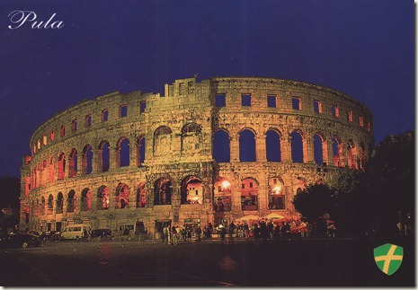
On postcard: Pula Arena

The Pula Arena is the name of the amphitheatre located in Pula, Croatia. The Arena is the only remaining Roman amphitheatre to have four side towers and with all three Roman architectural orders entirely preserved. It was constructed in 27 BC - 68 AD and is among the six largest surviving Roman arenas in the World. A rare example among the 200 Roman surviving amphitheatres of unique technological solutions. It is also the best preserved ancient monument in Croatia.

The amphitheatre is depicted on the reverse of the Croatian 10 kuna banknote, issued in 1993, 1995, 2001 and 2004.

Construction

The exterior wall is constructed in limestone. The part facing the sea consists of three stories, while the other part has only two stories since the amphitheatre was built on a slope. The maximum height of the exterior wall is 29.40 m (96.5 ft). The first two floors have each 72 arches, while the top floor consists of 64 rectangular openings.

The axes of the elliptical amphitheatre are 132.45 and 105.10 m (434.5 and 344.8 ft) long, and the walls stand 32.45 m (106.5 ft) high. It could accommodate 23,000 spectators in the cavea, which had forty steps divided into two meniani. The seats rest directly on the sloping ground; The field for the games, the proper arena, measured 67.95 by 41.65 m (222.9 by 136.6 ft). The field was separated from the public by iron gates.

The arena had a total of 15 gates. A series of underground passageways were built underneath the arena along the main axis from which animals, ludi scenes and fighters could be released; stores and shops were located under the raked seating. The amphitheatre was part of the circuit of the gladiators.

Each of the four towers had two cisterns filled with perfumed water that fed a fountain or could be sprinkled on the spectators. The amphitheatre could be covered with velarii (large sails), protecting the spectators from sun or rain (as attested by rare construction elements).

This amphitheatre, through its remarkable conservation, has served as an excellent example for the study of ancient building techniques.

History

The Arena was built between 27 BC - 68 AD, as the city of Pula became a regional centre of Roman rule, called Pietas Julia. The name was derived from the sand that, since antiquity, covered the inner space. It was built outside the town walls along the Via Flavia, the road from Pula to Aquileia and Rome.

The amphitheatre was first built in timber during the reign of Augustus (2-14 AD). It was replaced by a small stone amphitheatre during the reign of emperor Claudius. In 79 AD it was enlarged to accommodate gladiator fights by Vespasian and to be completed in 81 AD under emperor Titus. This was confirmed by the discovery of a Vespasian coin in the malting.

A Christian martyr called Germanus was martyred in the arena in the fourth century AD.

The amphitheatre remained in use until the 5th century, when emperor Honorius prohibited gladiatorial combats. It was not until 681 that combat between convicts, particularly those sentenced to death, and wild animals was forbidden.

In the 5th century the amphitheatre began to see its stone plundered by the local populace. By the 13th century, the patriarch of Aquileia forbade further removal from the Arena.

Later use

In the Middle Ages the interior of the Arena was used for grazing, occasional tournaments by the Knights of Malta and medieval fairs. In 1583 the Venetian Senate proposed dismantling the arena and rebuilding it within Venice. The proposals were rejected. Today, a headstone celebrating the Venetian senator Gabriele Emo's opposition to the plan is currently visible on the second tower.

In 1709, stone was taken from Pula arena for the belfry foundations at Pula Cathedral. This was the last time the arena was used as a source of stone.

Restoration

General Auguste de Marmont, as French governor of the Illyrian Provinces, started the restoration of the arena. This was continued in 1816 by the Ticinese architect Pietro Nobile, commissioned by the emperor Francis I of Austria.

In 1932, it was adapted for theatre productions, military ceremonies and public meetings. In its present state it still seats some 5,000 spectators.

Present day

The arena is used as a venue for many concerts. Performances have included Luciano Pavarotti, Đorđe Balašević, Andrea Bocelli, Jose Carreras, Dino Merlin, Jamiroquai, Anastacia, Eros Ramazzoti, Maksim Mrvica, Norah Jones, Zucchero, Zdravko Čolić, Alanis Morisette, Sinéad O'Connor, Elton John, Sting, Michael Bolton, Seal, Il Divo, Gibonni, Manu Chao and Oliver Dragojević.

The arena has also been used for cinematic works such as Titus, a 1999 film adaptation of Shakespeare's revenge tragedy Titus Andronicus.

Image0050

Image0049

FI-1306505 358 - ая открытка

Country: Finland

Distance: 752 km

Travel time:  7 days

Image0045

Image0046

TW-441996 357 - ая открытка

Country: Taiwan

Distance: 8,460 km

Travel time:  11 days

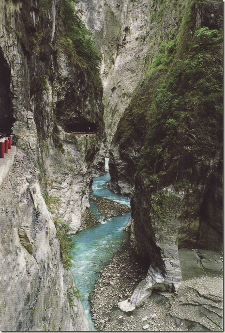
On postcard: Taroko National Park

Taroko National Park (Chinese: 太魯閣國家公園; pinyin: Tàilǔgé gúojiā gōngyuán; Pe̍h-ōe-jī: Taroko kok-ka kong-hn̂g) is one of the seven national parks in Taiwan and was named after the Taroko Gorge, the landmark gorge of the park. The park spans Taichung City, Nantou County, and Hualien County.

The park was originally established as the Tsugitaka-Taroko National Park (次高タロコ国立公園 Tsugitaka Taroko kokuritsu kōen) by the Governor-General of Taiwan on December 12, 1937 when Taiwan was part of the Empire of Japan. After the Empire of Japan's defeat in World War II, the Republic of China assumed control of Taiwan. The ROC government subsequently abolished the park on August 15, 1945. It was not until November 28, 1986 that the park was reestablished.

Origin of the name

The name, Taroko, means "magnificent and beautiful" in Truku, the language of a local indigenous people group. Long ago a Truku tribesman saw the beauty of the azure Pacific when he walked out of the gorge. On seeing the magnificent scene, he cried "Taroko!". And so it became the name of the place, in a fashion not dissimilar to how the island, Formosa, got its name.

Geology

Taroko Gorge and its surrounding area are well known for their abundant supply of marble, leading to its nickname, "The Marble Gorge". The rock now seen in Taroko began over 200 million years ago as sediment on the bottom of the ocean. As the sediment collected, it was subject to increasingly large amounts of pressure which eventually hardened it into limestone. Over the past 100 million years, tectonic compression between the Philippine Sea Plate and the Eurasian Plate supplied additional pressure that metamorphosed the limestone into marble. Uplifting forces from the plate collision pushed this rock above the surface of the ocean to where we see it today. In fact, the region is still being uplifted by approximately 0.5 cm per year.

The gorge itself was carved into the marble by the erosive power of the Liwu River.

In addition, there are known to be jade in this gorge. This jade is only found in Taiwan and the jade from this area supplies the jade market in Hualien. These mountains can be seen from rafting (a common activity during summer months in Taroko Gorge) through the rivers.

The Tupido Tribe Trail was built by the Batto Bulego family of Taroko some 120 years ago, and now only parts of its ruins remain on the Tianhsyang mesa (天祥台地). Four generations of the family resided there until the Japanese army massacred the tribe and banished the survivors in 1914.

Image0047

Image0048

DE-1201664 356 - ая открытка

Country: Germany

Distance: 767 km

Travel time:  4 days

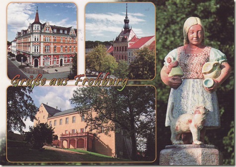
On postcard: Frohburg

Frohburg is a town in the Leipzig district, in the Free State of Saxony, Germany. It is situated 11 km northeast of Altenburg, and 34 km southeast of Leipzig. It includes the village of Flößberg.

History

During World War II, there was a satellite camp of Buchenwald concentration camp just outside the village of Flößberg. The slave labor camp was a factory of the Leipzig-based arms manufacturer, Hugo Schneider AG (HASAG).

Geography

Frohburg lies approximately halfway between Leipzig und Chemnitz, ca. 35 km south of Leipzig and 10 km south of Borna. The stream Wyhra flows through Frohburg.

Image0023

Image0024

GB-287785 355 - ая открытка

Country: United Kingdom

Distance: 1,680 km

Travel time:  6 days

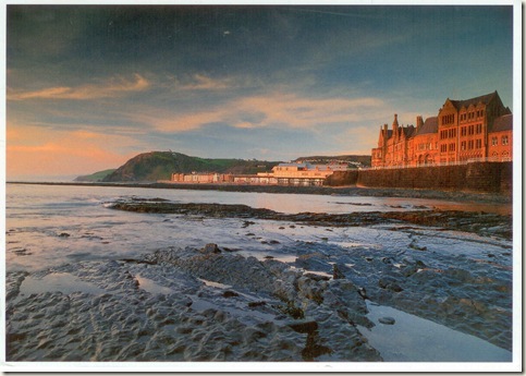
On postcard: Aberystwyth

Aberystwyth (English: Mouth of the River Ystwyth, is a historic market town, administrative centre and holiday resort within Ceredigion, Wales. Often colloquially known as Aber, it is located at the confluence of the rivers Ystwyth and Rheidol.

Since the late 19th century, Aberystwyth has also been a major Welsh educational centre, with the establishment of a university college there in 1872. The town's population was officially 15,935 in the 29 April 2001 census or 16,928 if local-government wards are tallied. During nine months of the year, there is an influx of students—to a total number of 8841 at July 2009, but there is no reliable measure of the number of those students whose family residence is outside Aberystwyth.

Geography

The town is situated near the confluence of the rivers Ystwyth and Rheidol, on the west coast of Wales. Although the name may seem to suggest otherwise, only the River Rheidol passes through the town; following the reconstruction of the harbour, the River Ystwyth skirts the town.

Aberystwyth has a pier and a fine seafront which stretches from Constitution Hill at the north end of the Promenade to the mouth of the harbour at the south, taking in two separate beach stretches divided by the castle. Today it is essentially made up by a number of different areas: Aberystwyth town, Llanbadarn Fawr, Waunfawr, Penparcau, Llanbadarn and Trefechan, with Penparcau being the most populous.

Aberystwyth is an isolated town, considering the population density of the United Kingdom. The nearest substantial settlements are located at least 1 hour 45 minutes' drive away: Swansea, to the south, is 70 miles (110 km) away; Shrewsbury, in Shropshire, England, to the east, is 75 miles (120 km) away; and Wrexham, to the north-east, is approximately 80 miles (130 km) away. The Welsh capital, Cardiff, is over 100 miles (160 km) away. London is 210 miles (340 km) distant from Aberystwyth.

175

176

PL-342564 354 - ая открытка

Country: Poland

Distance: 460 km

Travel time:  3 days

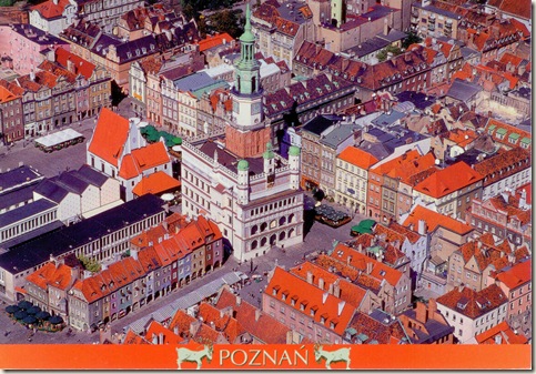
On postcard: Poznań Town Hall

Poznań Town Hall or Ratusz is a building in the city of Poznań in western Poland, located in the Old Market Square (Stary Rynek) in the centre of the Old Town neighbourhood. It served as the city's administrative building until 1939, and now houses a museum. The town hall was originally built in the late 13th century following the founding of the medieval city in 1253; it was rebuilt in roughly its present-day form, in mannerist style, with an ornate loggia, by Giovanni Battista di Quadro in 1550–1560. The display of mechanical fighting goats, played out daily at noon above the clock on the front wall of the building, is one of the city's main tourist attractions.

History

The town hall was originally constructed as the administrative building of the city founded on the left bank of the Warta in 1253 (seeHistory of Poznań). It was completed around 1300, during the reign of Wacław II Czeski, and was first documented in Latin in 1310 asDomus Consulum. It was a one-storey Gothic building built upon a raised quadrangle. The cellars remain from this period of construction. The building was extended in the 15th century, and at the turn of the century a tower was built at the north-western corner. The interior was remodeled between 1504 and 1508.

In 1536 the city suffered a major fire, which did serious damage to the town hall. Repair work was carried out in 1540–1542, particularly to the tower, but it remained unsafe. In 1550 the city' council commissioned Giovanni Battista di Quadro to carry out a major rebuilding. The work lasted until 1560. Di Quadro added an upper storey, extended the building towards the west, and added attic walls and a three-storey loggia. A new clock (installed 1551) was made with three full faces and one half-face, and with goats added as a "comic element" (see next section).

In 1675 the tower, clock and goats were destroyed by lightning. The tower was rebuilt in 1690 to a height of 90 metres (300 ft). The top of the tower was destroyed in a hurricane of 1725. In 1781–1784 major renovation was carried out on the building thanks to the efforts of the city's "Committee of Good Order", and it obtained the basic form which it presents today. A Classical-style tower roof was designed by Bonawentura Solari, and on the top was a white eagle with a two-metre wing span. On the eastern elevation Franciszek Cielecki painted Jagiellonian kings, and under the central turret was placed a cartouche with the king's initials "SAR" (Stanislaus Augustus Rex).

The next major renovation was carried out in 1910–1913 (during the period of German rule), when black rustication was used to give the building a more "northern German" style. The original late renaissance polychromy was destroyed. An additional storey was added and the goats, which had been absent since 1675, were restored to the tower in 1913. In October 1943 the Town Hall was the scene of Heinrich Himmler's Posen speeches. Following major damage in the Battle of Poznań (1945), the Town Hall was again rebuilt in 1945–1954, when the Renaissance character of the elevations was restored (and extracts from the constitution of the Polish People's Republic were added to the text displayed on the attic wall). The eagle, which had been kept hidden during the war, was returned to the tower in 1947. The mechanism that drives the goats was replaced in 1954, and again at the end of the century. Renovation carried out in 1992–2002 largely restored the building to its post-1784 appearance.

The goats and bugle call

Today the mechanical goats' butting display is performed daily at noon, preceded by the striking of the clock and the playing of a traditional bugle call (hejnał). At other hours between 7 am and 9 pm the same call is played on a carillon, installed in the tower in 2003. The daily appearance of the goats is one of Poznań's best-known tourist attractions.

A legend behind the original addition of the goats to the clock mechanism states that a cook, while preparing a banquet for the voivode and other dignitaries, had burnt a roast deer, and attempted to replace it by stealing two goats from a nearby meadow. The goats escaped and ran up the town hall tower, where they attracted the attention of the townspeople when they began to butt each other (according to some versions, this drew attention to a fire which might otherwise have done significant damage). Because of the entertainment provided, the voivode pardoned both the cook and the goats, and ordered that two mechanical goats be incorporated into the new clock being made for the building.

Another legend is associated with the hejnał. This says that Bolko, son of the tower's trumpeter, once took care of a crow whose wing had been shot through. The boy was then awoken at night by a gnome wearing a crown and purple cape, who thanked the boy for his kindness and handed him a small gold trumpet, telling him to blow it when in danger. After these words the gnome transformed into a crow and flew away. Years later, after Bolko had taken his father's place as trumpeter, when an attacking army was scaling Poznań's walls, Bolko remembered the present, ran to the top of the tower and began to play the trumpet. Dark clouds began to gather on the horizon, which turned out to be an enormous flock of crows that fell upon the attacking army and forced it to retreat. The trumpet was lost when Bolko dropped it in his astonishment, but the call which he played is still performed.

Rooms

The interior of the town hall consists of cellars, a ground floor and two upper storeys. The building currently serves as a Museum of the History of the City of Poznań (Muzeum Historii Miasta Poznania), a subdivision of the National Museum in Poznań.

Cellars and ground floor

The cellars were built between the 13th and 14th centuries. There was originally one large room with a supporting column in the centre; this was later divided into four rooms. Keystonesfeature the coat of arms of Poznań (crossed keys) and the Bohemian coat of arms (white lion with double tail) dating from the times of Wacław II Czeski. Until the 17th century the cellars were used to store goods, and in the 17th and 18th centuries they contained a prison and torture chamber. In the 19th century they were in use as a restaurant. They were later used as museum rooms, and are currently being renovated.

The ground-floor rooms were originally built in Gothic style, but rebuilt in Renaissance style by G. B. di Quadro; only one room retains the original vault. The architect also added two rooms with lunette vaults. One of the original uses of these rooms was for the town archives.

Upper floors

The second floor of the building was originally used for utility functions; following World War II damage it was rebuilt as exhibition space, with ceilings modelled on those from the houses on the Old Market Square. However the first floor contained the grandest rooms, used for official purposes by the city's authorities – these include the Great Hall (Vestibule), the Royal Hall and the Courtroom, described below.

Great Hall

The Great Hall or Vestibule is designed in Renaissance style by G. B. di Quadro. It was originally used for important sittings of the city court. Over the entrance is a quotation from Aristotle's Politics, and on the hall side a quotation from the Third Psalm. The hall retains its original vaults with lunettes, supported by two columns and by corbels. The coffers and columns are ornamented (the ornamentation on the ceiling is sgraffito). The coffers in the northern part of the room have polychrome stucco decoration showing Hercules and Samson, David and Goliath, and Marcus Curtius. The lower coffers show the coats of arms of Poland, Lithuania, the House of Sforza (Bona Sforza was Polish queen consort to 1548), the Habsburgs (Catherine Habsburgwas queen consort from 1553) and Poznań, as well as an angel holding a board with the date 1555, the year the work was completed. Artists' signatures, house marks and representations of their tools can also be found. The southern part contains representations of animals and mythical creatures (elephant, lion, leopard, aegle, rhinoceros, griffin, Pegasus) and deities signifying heavenly bodies (the sun, the moon, Mercury, Venus, Mars,Jupiter and Saturn in the Ptolemeic system. Also in cross-shaped coffers are the heads of Moses and of Christ, the latter accompanied by another house mark.

On the western wall are two portals dating from 1508, which combine Gothic and Renaissance features. Gold-plated doors contain the Bohemian coat of arms, possibly dating from the time of Wacław II Czeski. Notable exhibits include a Venetian globe (1688), and busts of Roman emperors from the 3rd and 4th centuries, excavated in Italy in the 18th century.

The hall is currently used for concerts and for special weddings.

Royal Hall

The Royal Hall (Sala Królewska) was once richly decorated similarly to the Great Hall, and was used for meetings of the city council. It was partly restored in 1954 following war damage. Its name derives from the portraits of kings which once decorated the hall (the portraits on display today come from the National Museum's collections). The hall features a Renaissance sandstone fireplace (1541), moved here from the adjoining weighing house when that building was demolished in 1890 (it was rebuilt in its original style after World War II). There is also a portal dating from 1536, moved from a house on the Old Market Square (Stary Rynek 87).

Courtroom

The sala sądowa (courtroom) was used for minor court hearings. It retains Renaissance "mirror vaults", with polychrome decoration dating from between the late 16th and early 19th centuries. On the northern wall are personifications of four continents. On the wall to the right of the entrance is the painting Aeropagus Maioris Poloniae by Wacław Graff, which alludes to a court of 1726. Opposite the entrance is a marble statue of king Stanisław August Poniatowski, dating from 1783.

External features

The front of the building, facing east, features an ornately decorated, three-storey loggia. Between the arcade columns on the ground floor are five pairs of female figures, the first four pairs representing virtues: patience (paciencia), with a lamb and prudence (prudencia) with a mirror; charity (charitas) with two children and justice (iusticia) with scales and a sword; faith (fides) with a chalice and sword and hope (spes) with a thurible and the sun; andcourage (fortitudo) with a broken column and temperance (temperancia) pouring water from a vase into a bowl. The last pair is of two famous women from the Ancient World: Lucretia (Lucrecia) with a spear through her own breast, and Cleopatra (Cleapairi), with snakes twisted around her arms.

Between the ground and first floors runs a fresco in Latin text serving as a warning to judges. Below the first floor there is a series of medallions with figures from the Ancient World: the brothers Gaius Gracchus and Tiberius Sempronius Gracchus, Lucius Junius Brutus, Archimedes, Vitruvius, Virgil,Homer, Justinian I, Horace, Spartacus, and the tyrannicides Harmodius and Aristogeiton.

Above the loggia is an attic wall, which features a list of rulers of the Jagiełło Dynasty from Władysław II Jagiełło and Jadwiga of Poland to Sigismund II Augustus. In the centre is a small tower, at the foot of which the goats appear for their daily display. Below this is a clock, connected with the mechanism that controls the goats. Below that is the monogram of Stanisław August Poniatowski ("SAR").
173

174

TW-440234 353 - ая открытка

Country: Taiwan

Distance: 8,506 km

Travel time:  7 days

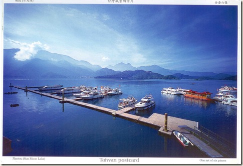
On postcard: Nantou (Sun Moon Lake)

Sun Moon Lake (Chinese: 日月潭; pinyin: Rìyuètán; Wade–Giles: Jih4-yüeh4-t'an2; Pe̍h-ōe-jī: Ji̍t-goa̍t-thâm; Zintun in the Thao language) is the largest body of water in Taiwan as well as a tourist attraction. Situated in Yuchi, Nantou, the area around the Sun Moon Lake is home to the Thao tribe, one of aboriginal tribes in Taiwan. Sun Moon Lake surrounds a tiny island called Lalu. The east side of the lake resembles a sun while the west side resembles a moon, hence the name.

Overview

Sun Moon Lake is located 748 m (2,454 ft) above sea level. It is 27 m (89 ft) deep and has a surface area of approximately 7.93 km2(3.06 sq mi). The area surrounding the lake has many trails for hiking.
While swimming in Sun Moon Lake is usually not permitted, there is an annual 3-km race called the Swimming Carnival of Sun Moon Lake held around the Mid-Autumn Festival each year. In recent years the participants have numbered in the tens of thousands. Other festivities held at the same time include fireworks, laser shows, and concerts.

The lake and its surrounding countryside have been designated one of thirteen National scenic areas in Taiwan. Wen Wu Temple (文武廟) was built after rising water levels from building a dam forced several smaller temples to be removed. Ci En Pagoda (慈恩塔) was built by late President Chiang Kai-shek in 1971 in memory of his mother. Other temples of note include Jianjing Temple, Syuentzang Temple, and Syuanguang Temple.

History

In older English literature it was commonly referred to as Lake Candidius, after the 17th century Dutch missionary Georgius Candidius. In the middle of the lake is the Lalu Island, which is the holy ground for the Thao tribe. In legend, Thao hunters discovered Sun Moon Lake while chasing a white deer through the surrounding mountains. The deer eventually led them to the lake, which they found to be not only beautiful, but abundant with fish. Today, the white deer of legends is immortalized as a marble statue on Lalu Island.

Under the Japanese colonial era of Taiwan, the Japanese named it the "Jade Island". After Chiang Kai-shek's Nationalist Government moved to Taiwan, the island was renamed Kuang Hua ("Glorious China") and in 1978 the local government built a pavilion where annual weddings took place. The 921 Earthquake destroyed the pavilion and sunk most of the island. In recent years, due to increasing social and political awareness, more deference and recognition are being given to Taiwanese aborigines. As a result, after 921 earthquake, the island was renamed in the Thao language as "Lalu".

Several hydroelectric power plants have been built in the Sun Moon Lake since 1919, including Mingtan. When the first hydroelectric plant was finished in 1934, it was considered to be one of the most important infrastructure constructions of the time. The Jiji Line railroad was built to facilitate the construction.

17

172