FR-152069 160 - ая открытка

Country: France

Distance:  1,450 km

Travel time:  8 days

On postcard: Melun


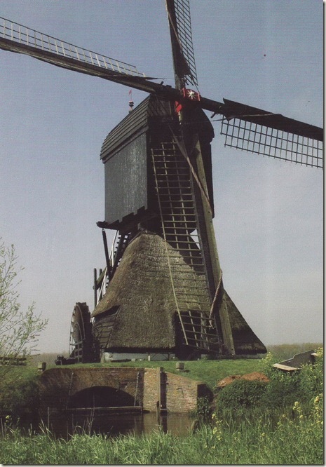
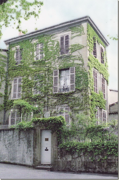
Melun is a commune in the Seine-et-Marne department in the Île-de-France region in north-central France. Located in the south-eastern suburbs of Paris, Melun is the capital of the department, as the seat of an arrondissement. Its inhabitants are called Melunais.

Meledunum began as a Gaulish town; Caesar noted Melun as "a town of the Senones, situated on an island in the Seine"; at the island there was a wooden bridge, which his men repaired. Roman Meledunum was a mutatio where fresh horses were kept available for official couriers on the Roman road south-southeast of Paris, where it forded the Seine.

The Normans sacked it in 845. The castle of Melun became a royal residence of the Capetian kings. Hugh Capet (See also: House of Capet) gave Melun to Bouchard, his favorite. In the reign of Hugh's son, Robert II of France, Eudes, the count of Champagne, bought the city, and the king took it back for the viscount in 999. Le Chatelain and his wife, who had sold the city, were hanged. Robert died there in July 1031.

paris

NL-677699 159 - ая открытка

Country: Holland

Distance:  1,140 km

Travel time:  11 days

Image0047

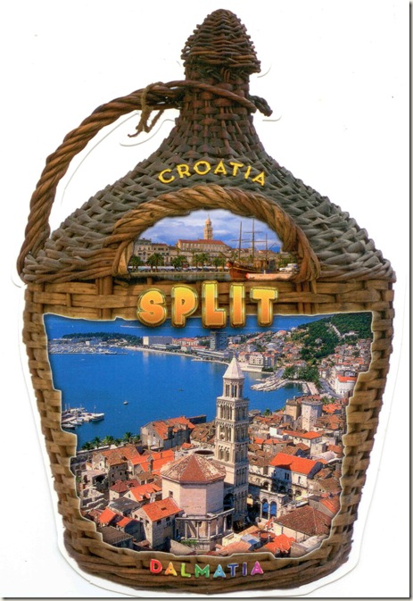
Split, Republika Hrvatska

split

FI-1117796 158 - ая открытка

Country: Finland

Distance: 535 km

Travel time:  3 days

atv

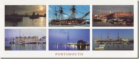
Portsmouth, Hampshire, England

Portsmouth is the second largest city in the ceremonial county of Hampshire on the south coast of England. Portsmouth is notable for being the United Kingdom's only island city, which is mainly located on Portsea Island. It is situated 64 miles (103 km) south west from London and 19 miles (31 km) south east from Southampton.

As a significant naval port for centuries, Portsmouth is home to the world's oldest dry dock still in use and also home to some famous ships, including the HMS Warrior and Lord Nelson's flagship, HMS Victory. Although smaller than in its heyday, the naval base remains a major dockyard and base for the Royal Navy and Royal Marine Commandos whose Headquarters resides there. There is also a thriving commercial ferryport serving destinations on the continent for freight and passenger traffic. The City of Portsmouth and Portsmouth Football Club are both nicknamed Pompey.

The Spinnaker Tower is a striking recent addition to the city's skyline. It can be found in the redeveloped former HMS Vernon, an area of retail outlets, restaurants, clubs and bars now known as Gunwharf Quays.

The City of Portsmouth has a population of 197,700 and is the only city in England with a greater population density (4,639 /km2 (12,010 /sq mi)) than London (4,562 /km2 (11,820 /sq mi)). The Portsmouth Urban Area includes Fareham, Portchester, Gosport, Havant and is the 14th largest urban area in the United Kingdom with an estimated 442,252 residents. Portsmouth combines with Southampton to form a single metropolitan area stretching from Salisbury to Bognor Regis. With a population of 1,547,000 this is the United Kingdom's eighth most populous metropolitan area.

On the postcard: second row first from right: HMS Warrior (1860)

Name:
HMS Warrior

Ordered:
11 May 1859

Builder:
Thames Ironworks and Shipbuilding Co. Ltd

Cost:
£377,292

Laid down:
25 May 1859

Launched:
29 December 1860

Commissioned:
1 August 1861

Status:
Museum ship

General characteristics

Class and type:
Warrior class armoured frigate

Displacement:
9,210 long tons (9,358 t)

Length:
418 feet (127 m)

Beam:
58.4 ft (17.8 m)

Draught:
26 ft (7.9 m)

Propulsion:
Penn jet-condensing, horizontal trunk, single expansion steam engine

Sail plan:
Full rigged ship

Speed:

13 knots (24.1 km/h) (sail)

14.5 kn (26.9 km/h) (steam)
17.5 kn (32.4 km/h) (combined)

Complement:
705 officers and men

Armament:

26 muzzle-loading 68-pounder guns
10 RBL 7 inch Armstrong guns

4 RBL 40 pounder Armstrong guns

HMS Warrior was the first iron-hulled, armour-plated warship, built for the Royal Navy in response to the first ironclad warship, the French La Gloire, launched a year earlier.

When completed in October 1861, Warrior was by far the largest, fastest, most heavily armed and most heavily armoured warship the world had ever seen. She was almost twice the size of La Gloire and thoroughly outclassed the French ship in speed, armour, and gunnery.

Warrior did not introduce any radical new technology, but for the first time combined steam engines, rifled breech-loading guns, iron construction, iron armour, and the propeller in one ship, and all built to an unprecedented scale.

Her construction started an intense international competition between guns and armour that did not end until air power made battleships obsolete in the Second World War. Warrior became an early example of the trend towards rapid battleship obsolescence and was withdrawn as a fighting unit in May 1883. Listed as part of the National Historic Fleet, Core Collection, she is now a museum ship in Portsmouth, United Kingdom.

On the postcard: second row in the middle: Spinnaker Tower, Harbourfront

Spinnaker Tower is a 170 m (557 ft 9 in)–high tower in Portsmouth, England. It is the centrepiece of the redevelopment of Portsmouth Harbour, which was supported by a National Lottery grant. Its shape was chosen by Portsmouth residents from a selection of concepts. The tower, designed by local firm HGP Architects and the engineering consultants Scott Wilson and built by Mowlem, reflects Portsmouth's maritime history by being modeled after a sail. After several years of delays and cost overruns, it was opened on 18 October 2005.

The tower, at a height of 170 metres (557 feet 9 inches) above sea level, is 2½ times higher than Nelson's Column, making it the tallest accessible structure in the United Kingdom outside London. The tower is visible for miles around Portsmouth, changing the horizon of the area. It can be seen from the Isle of Wight, and even the Manhood Peninsula.

The tower represents sails billowing in the wind, a design accomplished using two large, white, sweeping steel arcs, which give the tower its spinnaker sail design. The steelwork was fabricated by Butterley Engineering. At the top is a triple observation deck, providing a 320° view of the city of Portsmouth, the Langstone and Portsmouth harbours, and a viewing distance of 37 kilometres (23 mi). The highest of the three observation platforms, the crow's nest, has a wire mesh roof, allowing visitors to be in the elements. Windows extend to above head height, so it is not possible to get a view unobstructed by glass. The glass floor is the largest in Europe. The tower has a design lifetime of 80 years.

The design is similar to the Burj Al Arab in Dubai, whose structure is a little less than twice as tall at 323 metres (1,059 ft 9 in).

Planning began in 1995, and construction began 2001, and was completed in mid-2005, due to repeated delays and extra funding requests by the builders Mowlem. This was six years later than the planned opening date of 1999, chosen to coincide with Millennium celebrations. The tower, originally called Portsmouth Millennium Tower, was renamed Spinnaker Tower.

The project was over budget, with an overall cost of £35.6 million for the tower alone. Taxpayers were not meant to fund the tower, but Portsmouth City Council eventually contributed £11.1 million towards construction.

In March 2004, Portsmouth Council's former leader Cllr Leo Madden resigned from leading the Labour Group on the Council after a highly critical report of the council's handling of the project and failure to exploit revenue opportunities, such as the Millennium. Barry Smith, the project's legal advisor, also retired after being suspended on full pay, mostly due to controversy over the contract with the builders, which at one point would have cost the council more to cancel than to complete. In 2009 as Tower Revenues drop the council has again lost out as its income is linked to the tower's profits which have fallen significantly in 2008/9.

The tower has had a number of health and safety issues since opening, including large cracks beneath the observation deck and a malfunctioning external glass lift. Fathers 4 Justice campaigners and base jumpers have infiltrated the tower, leading to security concerns.

The tower was dedicated on 16 October 2005 and opened two days later. On opening day, the Tower's project manager, David Greenhalgh, and representatives for Mowlem and Maspero were stranded in the tower's malfunctioning external lift (built by Maspero) for an hour and a half. Abseiling engineers were called to rescue them. Some, including the franchise's chief executive, felt it was rather fitting that these particular people were trapped.

Once open, the tower attracted crowds in excess of expectations, despite only the internal lift working since opening, with over 600,000 people visiting the tower the first year. It is one of a number of observation towers around the world that have become popular, including Vancouver's Harbour Centre, Toronto's CN Tower, Blackpool's Tower and Shanghai's Oriental Pearl Tower.

In June 2006, the local press raised a concern that the tower may be forced to close. All public buildings in the UK require disabled access under the 1995 Disability Discrimination Act. With the external lift inoperative and only the internal lift for disabled access, the tower did not meet this requirement, and the tower operators could be sued under the act. This problem was rectified by investing in an evacuation chair, and training for staff to use it. In the event of evacuation, should the internal lift be inoperable, those unable to navigate the 570 steps can use the evacuation chair.

The original date given for the external lift to be operational was the end of January 2007, although as of December 2010 the lift is not in service.

The Spinnaker, being a southern landmark features on the BBC South Today news programme. It also features on ITV News.

Visitor numbers are down year on year and tower management admit interest is starting to fade. However, in June 2009 Tower operators succeed in gaining permission for a free fall ride, despite criticism, to be attached to the Tower in an attempt to boost falling visitor numbers and revenue.

In 2006, the tower won the RICS Project of the year award and the RICS Regeneration award.

On the postcard: first row in the middle: HMS Victory

Name:
HMS Victory

Ordered:
14 July 1758

Builder:
Chatham Dockyard

Laid down:
23 July 1759

Launched:
7 May 1765

Commissioned:
1778

Honours and
awards:

Participated in:

Status:
Active, preserved at Portsmouth, England
General characteristics

Class and type:
104-gun first-rate ship of the line

Displacement:
3,500 tons (3,556 tonnes)

Tons burthen:
2,142 tons bm

Length:

186 ft (57 m) (gundeck),

227 ft 6 in (69.34 m)(overall)

Beam:
51 ft 10 in (15.80 m)

Draught:
28 ft 9 in (8.76 m)

Depth of hold:
21 ft 6 in (6.55 m)

Propulsion:
Sails—6,510 sq yd (5,440 m²)

Sail plan:
Full-rigged ship

Speed:
8 to 9 knots (15 to 17 km/h) maximum

Complement:
Approximately 850

Armament:

Trafalgar:

  • Gundeck: 30 × 2.75 ton long pattern Blomefield 32 pounders (15 kg)
  • Middle gundeck: 28 × 2.5 ton long 24 pounders (11 kg)
  • Upper gundeck: 30 × 1.7 ton short 12 pounders (5 kg)
  • Quarterdeck: 12 × 1.7 ton short 12 pounder (5 kg)
  • Forecastle: 2 × medium 12 pounder (5 kg), 2 × 68 pounder (31 kg) carronade
Marines armed with muskets

Armour:
None, although oak hull thickness at waterline 2 ft (0.6 m)

Notes:
Height from waterline to top of mainmast: 205 ft (62.5 m

HMS Victory is a 104-gun first-rate ship of the line of the Royal Navy, laid down in 1759 and launched in 1765. She is most famous as Lord Nelson's flagship at the Battle of Trafalgar in 1805.

She was also Keppel's flagship at Ushant, Howe's flagship at Cape Spartel and Jervis's flagship at Cape St Vincent. After 1824 she served as a harbour ship.

In 1922 she was moved to a dry dock at Portsmouth, England, and preserved as a museum ship. She continues to be flagship of the Second Sea Lord and is the oldest naval ship still in commission.

Image0039

FR-149595 157 - aя открыткa

Country: France

Distance: 1,586 km

Travel time:  14 days

On postcard: The Jean Moulin Memorial in Caluire

"The Jean Moulin Memorial" in Caluire, on the site where Jean Moulin and his comrades of the High Command of the Secret Army were arrested on the 21st June 1943, is a symbolic site, a place of civic remembrance and a place for the future.
The arrest of General Delestraint "Vidal", head of the "Secret Army" on the 9th June 1943 in Paris, forced Jean Moulin to take interim measures to arrange his successor as quickly as possible and reorganise the army's operations. This was the reason for the meeting in Caluire. Jean Moulin charged André Lassagne with the task of choosing the meeting place, a house built in the 19th century in Caluire et Cuire, to the north of Lyon and rented by Doctor Frédéric Dugoujon.
The stakes were high midway through 1943, as some resistance fighters were anticipating the Allied landings "before the autumn leaves began to fall", and the opening of a second front was eagerly awaited by the Red Army in the East.
The battle against the occupying forces had now become a political battle looking towards the future... the ambitions of some leaders of the "Combat" movement began to emerge and spread at the expense of all the rules for safety.

On that day, the 21st June 1943, a short time after the arrival of the attendees, around ten men under the orders of Klaus Barbie, head of the Gestapo in Lyon, stormed the premises and arrested all those present. They were taken to the Gestapo's headquarters at the Military Medical School in Avenue Berthelot and then transferred to Fort Montluc before being deported. Jean Moulin was tortured and died in Metz during his transfer to Germany.
In this Memorial, the historical context is reconstructed through a film about the Prefect Moulin - the man himself, the story of his struggle from Chartres to Caluire and the exemplary nature of this patriot and republican in his mission as "REX". The whole story is expanded in a simple illustrated chronological frieze which lays out the key points of reference (dates, men and places) up until the trial of Klaus Barbie in 1987.
The four memorial rooms trace events and concentrate on the values of the Republic as defended by the commitment of the resistance fighters against the occupying forces and Nazism.

The end result of the violent confrontation experienced on the afternoon of the 21st June at 3pm is to provoke reflection on the ever-present struggle between political and religious totalitarianism and the Republic of free and lay citizens.
Moreover, this place of remembrance and history is timeless, in the way it links to the present through the reconciliation and construction of a European Union, born from the spirit of solidarity in the face of tyranny.
The house of Dugoujon was included on the list of historical monuments on the17th July 1990 as a place of major importance for the Résistance.
In 2010, it was renovated by the Département of the Rhône and converted into a Memorial that was opened by François Fillon on the 21st June 2010.

Image0038

Canterbury Cathedral, Canterbury, Kent, England

Canterbury Cathedral in Canterbury, Kent, is one of the oldest and most famous Christian structures in England and forms part of a World Heritage Site.

It is the cathedral of the Archbishop of Canterbury, leader of the Church of England and symbolic leader of the worldwide Anglican Communion. Its formal title is the Cathedral and Metropolitical Church of Christ at Canterbury.

History

Foundation by Augustine

The cathedral's first archbishop was Augustine of Canterbury, previously abbot of St. Andrew's Benedictine Abbey in Rome. He was sent by Pope Gregory the Great in 597 as a missionary to the Anglo-Saxons. Augustine founded the cathedral in 602 and dedicated it to St. Saviour. Archaeological investigations under the nave floor in 1993 revealed the foundations of the original Saxon cathedral, which had been built across a former Roman road.

Augustine also founded the Abbey of St. Peter and Paul outside the city walls. This was later rededicated to St. Augustine himself and was for many centuries the burial place of the successive archbishops. The abbey is part of the World Heritage Site of Canterbury, along with the ancient Church of St. Martin.

Later Saxon and Viking periods

A second building, a baptistry or mausoleum, was built on exactly the same axis as the cathedral by Archbishop Cuthbert (740-758) and dedicated to St. John the Baptist.

Two centuries later, Oda (941-958) renewed the building, greatly lengthening the nave.

During the reforms of Archbishop St. Dunstan (c909-988), a Benedictine abbey named Christ Church Priory was added to the cathedral. But the formal establishment as a monastery seems to date to c.997 and the community only became fully monastic from Lanfranc's time onwards (with monastic constitutions addressed by him to prior Henry). St. Dunstan was buried on the south side of the High Altar.

The Saxon cathedral was badly damaged during Danish raids on Canterbury in 1011. The Archbishop, St. Alphege, was held hostage by the raiders and eventually martyred at Greenwich on April 19, 1012, the first of Canterbury's five martyred archbishops. Lyfing (1013–1020) and Aethelnoth (1020–1038) added a western apse as an oratory of St. Mary.

Priors of Christ Church Priory included John of Sittingbourne (elected 1222, previously a monk of the priory) and William Chillenden, (elected 1264, previously monk and treasurer of the priory). The monastery was granted the right to elect their own prior if the seat was vacant by the pope, and — from Gregory IX onwards — the right to a free election (though with the archbishop overseeing their choice). Monks of the priory have included Æthelric I, Æthelric II, Walter d'Eynsham, Reginald fitz Jocelin (admitted as a confrater shortly before his death), Nigel de Longchamps and Ernulf. The monks often put forward candidates for Archbishop of Canterbury, either from among their number or outside, since the archbishop was nominally their abbot, but this could lead to clashes with the king and/or pope should they put forward a different man — examples are the elections of Baldwin of Forde and Thomas Cobham.

Norman period

After the Norman Conquest in 1066, Lanfranc (1070–1077) became the first Norman archbishop. He thoroughly rebuilt the ruined Saxon cathedral in a Norman design based heavily on the Abbey of St. Etienne in Caen, of which he had previously been abbot. The new cathedral was dedicated in 1077.

Archbishop St. Anselm (1093–1109) greatly extended the quire to the east to give sufficient space for the monks of the greatly revived monastery. Beneath it he built the large and elaborately decorated crypt, which is the largest of its kind in England.

Though named for the 7th century founding archbishop, The Chair of St. Augustine may date from the Norman period. Its first recorded use is in 1205.

Martyrdom of Thomas Becket

A pivotal moment in the history of Canterbury Cathedral was the murder of Thomas Becket in the north-east transept on Tuesday 29 December 1170 by knights of King Henry II. The king had frequent conflicts with the strong-willed Becket and is said to have exclaimed in frustration, "Who will rid me of this turbulent priest?" The knights took it literally and murdered Becket in his own cathedral. Becket was the second of four Archbishops of Canterbury who were murdered (see also Alphege).

Following a disastrous fire of 1174 which destroyed the entire eastern end, William of Sens rebuilt the choir with an important early example of the Early English Gothic design, including high pointed arches, flying buttresses, and rib vaulting. Later, William the Englishman added the Trinity Chapel as a shrine for the relics of St. Thomas the Martyr. The Corona ('crown') Tower was built at the eastern end to contain the relic of the crown of St. Thomas's head which was struck off during his murder. Over time other significant burials took place in this area such as Edward Plantagenet (The 'Black Prince') and King Henry IV.

The income from pilgrims (some of whose journeys are famously described in Geoffrey Chaucer's "Canterbury Tales") who visited Becket's shrine, which was regarded as a place of healing, largely paid for the subsequent rebuilding of the Cathedral and its associated buildings. This revenue included the sale of pilgrim badges depicting Becket, his martyrdom, or his shrine.

12th century monastery

A curious bird's-eye view of Canterbury Cathedral and its annexed conventual buildings, taken about 1165, is preserved in the Great Psalter in the library of Trinity College, Cambridge. As elucidated by Professor Willis, it exhibits the plan of a great Benedictine monastery in the 12th century, and enables us to compare it with that of the 9th as seen at the abbey of Saint Gall. We see in both the same general principles of arrangement, which indeed belong to all Benedictine monasteries, enabling us to determine with precision the disposition of the various buildings, when little more than fragments of the walls exist. From some local reasons, however, the cloister and monastic buildings are placed on the north, instead, as is far more commonly the case, on the south of the church. There is also a separate chapter-house, which is wanting at St Gall.

The buildings at Canterbury, as at St Gall, form separate groups. The church forms the nucleus. In immediate contact with this, on the north side, lie the cloister and the group of buildings devoted to the monastic life. Outside of these, to the west and east, are the halls and chambers devoted to the exercise of hospitality, with which every monastery was provided, for the purpose of receiving as guests persons who visited it, whether clergy or laity, travellers, pilgrims or paupers.

To the north a large open court divides the monastic from the menial buildings, intentionally placed as remote as possible from the conventual buildings proper, the stables, granaries, barn, bakehouse, brewhouse, laundries, etc., inhabited by the lay servants of the establishment. At the greatest possible distance from the church, beyond the precinct of the convent, is the eleemosynary department. The almonry for the relief of the poor, with a great hall annexed, forms the paupers' hospitium.

The most important group of buildings is naturally that devoted to monastic life. This includes two Cloisters, the great cloister surrounded by the buildings essentially connected with the daily life of the monks,---the church to the south, the refectory or frater-house here as always on the side opposite to the church, and farthest removed from it, that no sound or smell of eating might penetrate its sacred precincts, to the east the dormitory, raised on a vaulted undercroft, and the chapter-house adjacent, and the lodgings of the cellarer to the west. To this officer was committed the provision of the monks' daily food, as well as that of the guests. He was, therefore, appropriately lodged in the immediate vicinity of the refectory and kitchen, and close to the guest-hall. A passage under the dormitory leads eastwards to the smaller or infirmary cloister, appropriated to the sick and infirm monks.

Eastward of this cloister extend the hall and chapel of the infirmary, resembling in form and arrangement the nave and chancel of an aisled church. Beneath the dormitory, looking out into the green court or herbarium, lies the "pisalis" or "calefactory," the common room of the monks. At its north-east corner access was given from the dormitory to the necessarium, a portentous edifice in the form of a Norman hall, 145 ft (44 m) long by 25 broad (44.2 m × 7.6 m), containing fifty-five seats. It was, in common with all such offices in ancient monasteries, constructed with the most careful regard to cleanliness and health, a stream of water running through it from end to end.

A second smaller dormitory runs from east to west for the accommodation of the conventual officers, who were bound to sleep in the dormitory. Close to the refectory, but outside the cloisters, are the domestic offices connected with it: to the north, the kitchen, 47 ft (14 m) square (200 m2), surmounted by a lofty pyramidal roof, and the kitchen court; to the west, the butteries, pantries, etc. The infirmary had a small kitchen of its own. Opposite the refectory door in the cloister are two lavatories, an invariable adjunct to a monastic dining-hall, at which the monks washed before and after taking food.

The buildings devoted to hospitality were divided into three groups. The prior's group "entered at the south-east angle of the green court, placed near the most sacred part of the cathedral, as befitting the distinguished ecclesiastics or nobility who were assigned to him." The cellarer's buildings were near the west end of the nave, in which ordinary visitors of the middle class were hospitably entertained. The inferior pilgrims and paupers were relegated to the north hall or almonry, just within the gate, as far as possible from the other two.

14th-16th centuries

The cathedral was seriously damaged by the severe earthquake of 1382, losing its bells and campanile. Prior Thomas Chillenden (1390–1410) rebuilt the nave in the Perpendicular style of English Gothic, but left the Norman and Early English east end in place.

Dissolution of the monasteries

The cathedral ceased to be an abbey during the Dissolution of the Monasteries when all religious houses were suppressed. Canterbury surrendered in March 1539, and reverted to its previous status of 'a college of secular canons'. The New Foundation came into being on 8 April 1541.

In 1688, the joiner Roger Davis, citizen of London, removed the 13th century misericords and replaced them with two rows of his own work on each side of the choir. Some of Davis's misericords have a distinctly medieval flavour and he may have copied some of the original designs. When Sir George Gilbert Scott performed his renovations in the 19th century, he ripped out the front row of Davis misericords, replacing them with his own designs, which themselves seem to contain many copies of the misericords at Gloucester Cathedral, Worcester Cathedral and New College, Oxford.

18th century to present

The original Norman northwest tower was demolished in the late 18th century due to structural concerns. It was replaced during the 1830s with a Perpendicular style twin of the southwest tower, currently known as the 'Arundel Tower'. This was the last major structural alteration to the cathedral to be made.

The Romanesque monastic dormitory ruins were replaced with a Neo-Gothic Library and Archives building in the 19th century. This building was later destroyed by a high-explosive bomb in the Second World War, which had been aimed at the cathedral itself but missed by yards, and was rebuilt in similar style several years later.

The cathedral is currently sponsoring a major fundraising drive to raise a minimum of £50 million to fund restoration. The cathedral is the Regimental Church of the Princess of Wales's Royal Regiment.

Canterbury Cathedral Appeal

In 2006, a new fundraising appeal to raise £50 million was launched to much media attention under the dramatic banner Save Canterbury Cathedral.

The Canterbury Cathedral Appeal was launched to protect and enhance Canterbury Cathedral's future as a religious, heritage and cultural centre. Every five years the cathedral carries out a major structural review. The last so-called Quinquennial made it very clear that a combination of centuries of weathering, pollution and constant use had taken its toll on the building and there were some serious problems at Canterbury Cathedral that needed urgent action.

Much of the cathedral's stonework is damaged and crumbling, the roofs are leaking and much of the stained glass is badly corroded. It is thought that if action is not taken now, the rate of decay and damage being inflicted on the building will increase dramatically with potentially disastrous results, including closure of large sections of the cathedral in order to guarantee the safety of the million plus worshippers, pilgrims and tourists who visit the cathedral every year.

The closure of parts of the cathedral would be seen as a significant loss of part of Britain's architectural heritage, and a huge limitation on the activities and services currently provided by the cathedral.

As well as restoring much of the historic beauty of the cathedral, the appeal aims to fund enhancements to visitor facilities and investment to build on the cathedral's significant musical tradition.

By November 2008, the current appeal had raised more than £9 million. Previous major appeals were run in the 1950s and 1970s.

In the summer of 2009, stones in the South West Transept were discovered to have cracked around several iron braces surrounding the Great South Window. The cracks are presumed to be the result of the metal expanding and contracting in hot and cold weather, and have severely compromised the structure of the window. The transept was immediately closed, in case the window were to collapse, while scaffolding was erected, and the area immediately in front of the inside of the window was closed off and covered, to maintain access via the south door beneath it. This area was given restoration priority immediately after the structural damage was discovered.

The Foundation

The Foundation is the authorised staffing establishment of the cathedral, few of whom are clergy. The head of the cathedral is the dean, currently the Very Reverend Robert Willis, who is assisted by a chapter of 24 canons, four of whom are residentiary, the others being honorary appointments of senior clergy in the diocese. There are also a number of lay canons who altogether form the greater chapter which has the legal responsibility both for the cathedral itself and also for the formal election of an archbishop when there is a vacancy-in-see. By English law and custom they may only elect the person who has been nominated by the monarch on the advice of the prime minister. The Foundation also includes the choristers, lay clerks, organists, King's Scholars, the Six Preachers and a range of other officers; some of these posts are moribund, such as that of the cathedral barber. The cathedral has a full-time work force of 300 making it one of the largest employers in the district and in addition also has approximately 800 volunteers.

Bells

The cathedral has a total of twenty one bells in the three towers:

The South West Tower (Oxford Tower) contains the cathedral’s main ring of bells, hung for change ringing in the English style. There are fourteen bells – a ring of twelve with two semi-tones, which allow for ringing on ten, eight or six bells while still remaining in tune. All of the bells were cast in 1981 by the Whitechapel Bell Foundry from seven bells of the old peal of twelve with new metal added, and re-hung in a new frame. The length (draught) of the ropes was increased by lowering the floor of the ringing chamber to the level of the south aisle vault at the same time. The heaviest bell of this ring weighs 34cwt (1.72 tonnes). The ringers practice on Thursday at 7.30pm.

The North West Tower (Arundel Tower) contains the cathedral’s clock chime. The five quarter chimes were taken from the old peal of twelve in the Oxford Tower (where the clock was originally), and hung from beams in the Arundel Tower. The chimes are stuck on the eighth Gregorian tone, which is also used at Merton College, Oxford. The hour is struck on Great Dunstan, the largest bell in Kent 63cwt (3.2 tonnes), which is also swung on Sunday mornings for Matins.

In 1316 Prior Henry of Eastry, probably the Cathedral’s greatest single benefactor, gave a large bell dedicated to St Thomas, which weighed 71½ cwt (3.63 tonnes). Later, in 1343, Prior Hathbrand gave bells dedicated to Jesus and St Dunstan. At this time the bells in campanile were rehung and their names recorded as “Jesus”, “Dunstan”, “Mary”, “Crundale”, “Elphy” (Alphege) and “Thomas”.

In the great earthquake of 1382 the campanile fell, destroying the first three named bells. Following its reconstruction, the other three bells were rehung, together with two others, of whose casting no record remains

The oldest bell in the cathedral is Bell Harry, which hangs in a cage atop the central tower to which the bell lends its name. This bell was cast in 1635, and is struck at 8am and 9pm every day to announce the opening and closing of the cathedral respectively, and also occasionally for services as a Sanctus bell.
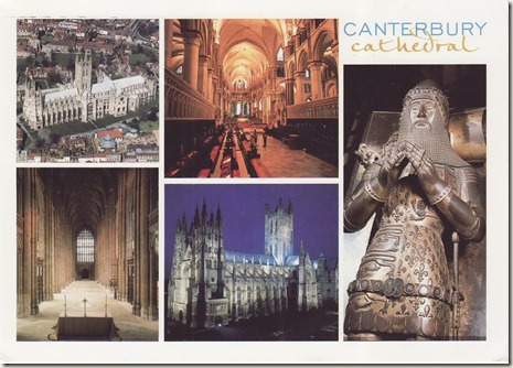
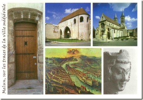
Image0036

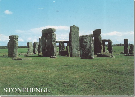
Stonehenge, Wiltshire, England

Stonehenge is a prehistoric monument located in the English county of Wiltshire, about 3.2 kilometres (2.0 mi) west of Amesbury and 13 kilometres (8.1 mi) north of Salisbury. One of the most famous sites in the world, Stonehenge is composed of earthworks surrounding a circular setting of large standing stones. It is at the centre of the most dense complex of Neolithic and Bronze Age monuments in England, including several hundred burial mounds.

Archaeologists have believed that the iconic stone monument was erected around 2500 BC, as described in the chronology below. One recent theory however, has suggested that the first stones were not erected until 2400–2200 BC, whilst another suggests that bluestones may have been erected at the site as early as 3000 BC (see phase 1 below). The surrounding circular earth bank and ditch, which constitute the earliest phase of the monument, have been dated to about 3100 BC. The site and its surroundings were added to the UNESCO's list of World Heritage Sites in 1986 in a co-listing with Avebury Henge monument. It is a national legally protected Scheduled Ancient Monument. Stonehenge is owned by the Crown and managed by English Heritage, while the surrounding land is owned by the National Trust.

Archaeological evidence found by the Stonehenge Riverside Project in 2008 indicates that Stonehenge served as a burial ground from its earliest beginnings. The dating of cremated remains found on the site indicate burials from as early as 3000 BC, when the initial ditch and bank were first dug. Burials continued at Stonehenge for at least another 500 years.

The Oxford English Dictionary cites Ælfric's 10th-century glossary, in which henge-cliff is given the meaning "precipice", a hanging or supported stone, thus the stanenges or Stanheng "not far from Salisbury" recorded by 11th-century writers are "supported stones". William Stukeley in 1740 notes, "Pendulous rocks are now called henges in Yorkshire...I doubt not, Stonehenge in Saxon signifies the hanging stones." Christopher Chippindale's Stonehenge Complete gives the derivation of the name Stonehenge as coming from the Old English words stān meaning "stone", and either hencg meaning "hinge" (because the stone lintels hinge on the upright stones) or hen(c)en meaning "hang" or "gallows" or "instrument of torture". Like Stonehenge's trilithons, medieval gallows consisted of two uprights with a lintel joining them, rather than the inverted L-shape more familiar today.

The "henge" portion has given its name to a class of monuments known as henges.Archaeologists define henges as earthworks consisting of a circular banked enclosure with an internal ditch. As often happens in archaeological terminology, this is a holdover from antiquarian usage, and Stonehenge is not truly a henge site as its bank is inside its ditch. Despite being contemporary with true Neolithic henges and stone circles, Stonehenge is in many ways atypical – for example, at over 24 feet (7.3 m) tall, its extant trilithons supporting lintels held in place with mortise and tenon joints, make it unique.

Function and construction

Stonehenge was produced by a culture that left no written records. Many aspects of Stonehenge remain subject to debate. This multiplicity of theories, some of them very colourful, are often called the "mystery of Stonehenge".

There is little or no direct evidence for the construction techniques used by the Stonehenge builders. Over the years, various authors have suggested that supernatural or anachronistic methods were used, usually asserting that the stones were impossible to move otherwise. However, conventional techniques using Neolithic technology have been demonstrably effective at moving and placing stones of a similar size. Proposed functions for the site include usage as an astronomical observatory, or as a religious site.

More recently two major new theories have been proposed. Professor Mike Parker Pearson, head of the Stonehenge Riverside Project, has suggested that Stonehenge was part of a ritual landscape and was joined to Durrington Walls by their corresponding avenues and the River Avon. He suggests that the area around Durrington Walls Henge was a place of the living, whilst Stonehenge was a domain of the dead. A journey along the Avon to reach Stonehenge was part of a ritual passage from life to death, to celebrate past ancestors and the recently deceased. On the other hand, Geoffery Wainwright, president of the Society of Antiquaries of London, and Timothy Darvill of Bournemouth University have suggested that Stonehenge was a place of healing – the primeval equivalent of Lourdes. They argue that this accounts for the high number of burials in the area and for the evidence of trauma deformity in some of the graves. However they do concede that the site was probably multifunctional and used for ancestor worship as well. Isotope analysis indicates that some of the buried individuals were from other regions. A teenage boy buried approximately 1550 BC was raised near the Mediterranean Sea; a metal worker from 2300 BC dubbed the "Amesbury Archer" grew up near the alpine foothills of Germany; and the "Boscombe Bowmen" likely arrived from Wales or Brittany, France.

Whatever religious, mystical or spiritual elements were central to Stonehenge, its design includes a celestial observatory function, which might have allowed prediction of eclipse, solstice, equinox and other celestial events important to a contemporary religion

 Modern history

Folklore

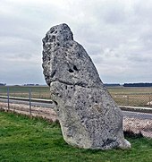
"Heel Stone," "Friar’s Heel" or "Sun-Stone"

The Heel Stone lies just outside the main entrance to the henge, next to the present A344 road. It is a rough stone, 16 feet (4.9 m) above ground, leaning inwards towards the stone circle. It has been known by many names in the past, including "Friar's Heel" and "Sun-stone". Today it is uniformly referred to as the Heel Stone or Heelstone. When one stands within Stonehenge, facing north-east through the entrance towards the heel stone, one sees the sun rise above the stone at summer solstice.

A folk tale, which cannot be dated earlier than the seventeenth century, relates the origin of the Friar's Heel reference.

The Devil bought the stones from a woman in Ireland, wrapped them up, and brought them to Salisbury plain. One of the stones fell into the Avon, the rest were carried to the plain. The Devil then cried out, "No-one will ever find out how these stones came here!" A friar replied, "That’s what you think!," whereupon the Devil threw one of the stones at him and struck him on the heel. The stone stuck in the ground and is still there.

Some claim "Friar's Heel" is a corruption of "Freyja's He-ol" from the Nordic goddess Freyja and the Welsh word for track. The Heel Stone lies beside the end portion of Stonehenge Avenue.

A more simple explanation for the name might be that the stone heels, or leans.

The name is not unique; there was a monolith with the same name recorded in the 19th century by antiquarian Charles Warne at Long Bredy in Dorset.

Arthurian legend

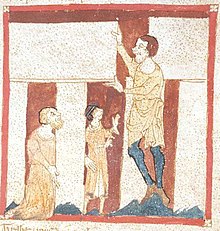
A giant helps Merlin build Stonehenge. From a manuscript of the Roman de Brut by Wace in the British Library (Egerton 3028). This is the oldest known depiction of Stonehenge.

In the 12th century, Geoffrey of Monmouth included a fanciful story in his work Historia Regum Britanniae that attributed the monument's construction to Merlin. Geoffrey's story spread widely, appearing in more and less elaborate form in adaptations of his work such as Wace's Norman French Roman de Brut, Layamon's Middle English Brut, and the Welsh Brut y Brenhinedd. According to Geoffrey, Merlin directed its removal from Ireland, where it had been constructed on Mount Killaraus by Giants, who brought the stones from Africa. After it had been rebuilt near Amesbury, Geoffrey further narrates how first Ambrosius Aurelianus, then Uther Pendragon, and finally Constantine III, were buried inside the ring of stones. In many places in his Historia Regum Britanniae Geoffrey mixes British legend and his own imagination; it is intriguing that he connects Ambrosius Aurelianus with this prehistoric monument as there is place-name evidence to connect Ambrosius with nearby Amesbury.

According to Geoffrey of Monmouth, the rocks of Stonehenge were healing rocks, called the Giant's dance, which giants brought from Africa to Ireland for their healing properties. Aurelius Ambrosias (5th century), wishing to erect a memorial to the 3,000 nobles, who had died in battle with the Saxons and were buried at Salisbury, chose Stonehenge (at Merlin's advice) to be their monument. So the King sent Merlin, Uther Pendragon (Arthur's father), and 15,000 knights to Ireland to retrieve the rocks. They slew 7,000 Irish but, as the knights tried to move the rocks with ropes and force, they failed. Then Merlin, using "gear" and skill, easily dismantled the stones and sent them over to Britain, where Stonehenge was dedicated. Shortly after, Aurelius died and was buried within the Stonehenge monument, or "The Giants' Ring of Stonehenge".

In another legend of Saxons and Britons, in 472 the invading king Hengist invited Brythonic warriors to a feast, but treacherously ordered his men to draw their weapons from concealment and fall upon the guests, killing 420 of them. Hengist erected the stone monument—Stonehenge—on the site to show his remorse for the deed.

Image0034

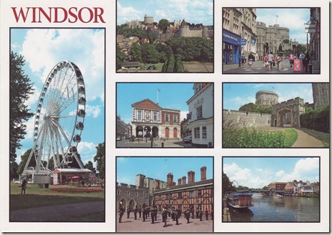
Windsor, Berkshire, England

Windsor is an affluent suburban town and unparished area in the Royal Borough of Windsor and Maidenhead in Berkshire, England. It is widely known as the site of Windsor Castle, one of the official residences of the British Royal Family.

The town is situated 21 miles (34 km) west of Charing Cross. It is immediately south of the River Thames, which forms its boundary with Eton. Windsor and the surrounding areas contain some of the most expensive and desirable housing in the UK. The village of Old Windsor, just over two miles to the south, predates what is now called Windsor by around 300 years; in the past Windsor was formally referred to as New Windsor to distinguish the two.

History

The early history of the site is unknown, although the site was almost certainly settled many years before the medieval castle was built. Histories of the town note that the combination of the navigable river and the strategically placed hill point to the likelihood of continuous human settlement from early times. Evidence includes archaeological finds from Windsor, such as palaeolithic hand-axes, neolithic flint picks, Bronze Age swords and an Iron Age brooch. Although Roman remains are few, there is ample evidence of Anglo Saxon settlement in the area.

Windsor is first mentioned in the Anglo-Saxon Chronicle. The name originates from old English Windles-ore, or 'winch by the riverside', a royal settlement, now called Old Windsor, located about three miles from the modern town. Windsor Castle was originally built by William the Conqueror in the decade after the Norman conquest of 1066, a timber motte and bailey structure in the manor of Clewer. It was noted in the Domesday Book as 'Windsor Castle'. Some time after 1086, probably in the reign of King Henry I, the royal household relocated three miles upstream to the recently-built castle. By 1110, important crown wearings (Great Council of state) were noted as taking place at the castle and King Henry married his second wife there in 1121, after the 'White Ship' disaster. The settlement at Old Windsor largely transferred to this 'New' Windsor during the 12th century, although substantial planning and setting out of the new town (including the parish church, marketplace, bridge and leper hospital) did not take place until c. 1170, following the civil war of Stephen's reign. At about the same time, the present upper ward of the castle was rebuilt in stone. Windsor Bridge is the earliest bridge on the Thames between Staines and Reading, having been built when bridge building was not common. It played an important part in the national road system, linking London with Reading and Winchester, but also by diverting traffic into the new town, underpinned its success.

The town of New Windsor, as an ancient demesne of the Crown, was a privileged settlement from the start, apparently having the rights of a 'free borough' for which other towns had to pay substantial fees to the king. It had a merchant guild (known by the fourteenth century as the Fraternity or brotherhood of the Trinity) from the early 13th century and, under royal patronage, was made the chief town of the county later in the same century. Windsor was granted royal borough status by Edward I's charter in 1277. This gave no new rights or privileges to Windsor but, as one historian puts it, "recognised [Windsor's] existence and gave it a legal status as a borough". Importantly, as a self governing town, it maintained a 'common cheest' paying for improvements to the town from its own resources. The town accounts of the sixteenth century survive, although most of the once substantial borough archive was destroyed, probably in the late seventeenth century.

New Windsor was a nationally significant town in the Middle Ages, certainly one of the fifty wealthiest towns in the country by 1332. Its prosperity came from its close association with the royal household. The repeated investment in the castle brought London merchants (goldsmiths, vintners, spicers and mercers) to the town and provided much employment for townsmen. The development of the castle under Edward III (1350–68), for example, was the largest secular building project in England of the Middle Ages, and many Windsor people worked in the castle on this building project. Henry III, a hundred years earlier, had spent more on Windsor Castle than on any other royal building project, save the rebuilding of Westminster Abbey. The Black Death in 1348, although reducing some towns' populations by up to 50%, seems to have had less of an impact in Windsor. Possibly 30% of the town's population died, but the building projects of Edward III brought many building workers to the town, possibly doubling the population: the Black Death, and the plagues that followed in 1361 - 72, were a 'boom' time for the local economy. New people came to the town from every part of the country, and from continental Europe, to benefit from royal expenditure at the castle. The poet Geoffrey Chaucer worked at Windsor Castle as 'Clerk of the Works' in 1391.

The development of the castle continued in the 15th century. Windsor became a major pilgrimage destination, particularly for Londoners. Pilgrims came to touch the royal shrine of the murdered Henry VI and the fragment of the True Cross in the new St George's Chapel (1480) and to visit the same king's college at Eton(Eton College), which was dedicated in 1440 to the Blessed Virgin Mary. Pilgrims came with substantial sums to spend. There were over 29 inns in Windsor to provide accommodation, some very large. The town became very prosperous. For London pilgrims, Windsor was probably second in importance only to Canterbury and the shrine of Saint Thomas Becket. Henry VIII was buried in St George's Chapel in 1547, next to the body of Jane Seymour, the mother of his only legitimate son, Edward (Edward VI). Henry, the founder of the Church of England, may have wanted to benefit from the stream of Catholic pilgrims coming to the town. His will gives that impression.

Tudor and Stuart periods

The town began to stagnate about ten years after the Reformation. The castle was considered old fashioned and shrines to the dead were thought to be 'superstitious'. The early modern period formed a stark contrast to the medieval history of the town. Most accounts of Windsor in the 16th and 17th centuries talk of its poverty, badly made streets and poor housing. Shakespeare's play The Merry Wives of Windsor is set in Windsor and contains many references to parts of the town and the surrounding countryside. Shakespeare must have walked the town's streets, near the castle and river, much as people still do. The play may have been written in the Garter Inn, although this was certainly not part of the modern Harte and Garter Hotel opposite the castle. Windsor was the home of the New Model Army and the castle was garrisoned by Colonel Venn during the English Civil War. Despite its royal dependence, like many commercial centres, Windsor was a Parliamentarian town. Charles I was buried without ceremony in St George's after his execution at Whitehall in 1649. The present Guildhall, built in 1680, replaced an earlier market hall that had been built on the same site around 1580, as well as the old guildhall, which faced the castle and had been built around 1370. The contraction in the number of public buildings speaks of a town in decline.

Georgian and Victorian periods

In 1778, there was a resumption of the royal presence, with George III at the Queen's Lodge and, from 1804, at the castle. This started a period of new development in Windsor, with the building of two army barracks. However the associated large numbers of soldiers led to a major prostitution problem by 1830 in a town where the number of streets had little changed since 1530. The substantial redevelopment of the castle in the subsequent decade and Queen Victoria's residence from 1840, as well as the coming of two railways in 1849, signalled the most dramatic changes in the town's history. It catapulted the town from a sleepy medieval has-been to the centre of Empire - many European crowned heads of state came to Windsor to visit the Queen throughout the rest of the 19th century. Unfortunately, excessive redevelopment and 'refurbishment' of Windsor's medieval fabric at this time resulted in widespread destruction of the old town, including the demolition of the old parish church of St John the Baptist in 1820. The original had been built in 1180.

Later periods

Most of the current town's streets date from the mid to late 19th century. However the main street, Peascod Street (pronounced Pes-cod Street) is very ancient, predating the castle by many years. It formed part of the 10th century parish structure in east Berkshire and in comparison, the 1000 year old royal castle, although the largest and longest occupied in Europe, is a recent development. "New Windsor" was officially renamed "Windsor" in 1974.

Tourism

As a result of the royal residence, Windsor is a popular tourist destination and has facilities usually found in larger towns: two railway stations, a theatre and several substantial hotels. The town is also the location of Legoland, built on the site of the former Windsor Safari Park. During construction, several tons of hippo excrement had to be removed from the enclosure used by the animals.

Regular return riverboat cruises operate daily from February to November from the Promenade, Barry Avenue. These include forty-minute and two-hour trips and provide unique views of the Castle.

The Royal Windsor Wheel is a more recent addition to the town's tourist attractions, and provides an overhead view of the surrounding area, including the castle, Eton and the Thames Valley. Located in Alexandra Gardens near the River Thames, it is assembled in the summer and dismantled in the autumn.

Image0014

Любимой сестричке!

Image0012

Happy Birthday More than words

Image0011

Happy Birthday

Image0013

Treasures

Image0010

С днём рожденья!

IMG_7693

NL-667044 156 - aя открыткa

Country: Holland

Distance: 1,092 km

Travel time:  6 days

otkr3

UA-109284 155 - aя открыткa

Country: Ukraine

Distance: 859 km

Travel time:  5 days

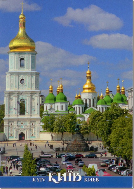
On postcard: Saint Sophia Cathedral in Kiev

Saint Sophia Cathedral in Kiev is an outstanding architectural monument of Kievan Rus'. Today, it is one of the city's best known landmarks and the first Ukrainian patrimony to be inscribed on the World Heritage List along with the Kiev Cave Monastery complex. The cathedral beside its main building includes an ensemble of supporting structures such as a bell tower, a house of metropolitan, and others. In 2011 the historic site was reassigned from the jurisdiction of the Ministry of Regional Development of Ukraine to the Ministry of Culture of Ukraine. One of the reason for that move was the fact that both "Sofia Kyivska" and Kiev Pechersk Lavra is recognized by the UNESCO World Heritage Program as one complex site, while in Ukraine their were governed by different government entities.

In Ukrainian the cathedral is known as Sobor Sviatoyi Sofiyi (Собор Святої Софії) or Sofiyskyi sobor (Софійський собор). In Russian it is known as Sobor Svyatoi Sofii (Собор Святой Софии) or Sofiyskiy sobor (Софийский собор).

The complex of the Cathedral is the main component and museum of the National Preserve "Sophia of Kiev" which is the state institution responsible for the preservation of the Cathedral complex as well as four other historic landmarks across the nation.

History

The cathedral's name comes from the 6th-century Hagia Sophia cathedral in Constantinople (meaning Holy Wisdom, and dedicated to the Holy Wisdom rather than a specific saint named Sophia). According to a less popular theory, its model was the 13-domed oaken Saint Sophia Cathedral in Novgorod (ca. 989), which Yaroslav I the Wise determined to imitate in stone as a sign of gratitude to the citizens of Novgorod who had helped him secure the Kievan throne in 1019.

The first foundations were laid out in 1037 (or 1011), but the cathedral took two decades to complete. The structure has 5 naves, 5 apses, and (quite surprisingly for Byzantine architecture) 13 cupolas. It is surrounded by two-tier galleries from three sides. Measuring 37 to 55 m (121 to 180 ft), the exterior used to be faced with plinths. On the inside, it retains mosaics and frescos from the eleventh century, including a dilapidated representation of Yaroslav's family, and the Orans.

Originally the cathedral was a burial place of the Kievan rulers including Vladimir Monomakh, Vsevolod Yaroslavich and of course the cathedral's founder Yaroslav I the Wise, although only the latter's grave survived to our days (see picture).

After the pillaging of Kiev by Andrei Bogolyubsky of Vladimir-Suzdal in 1169, followed by Mongolian Tatars in 1240, the cathedral fell into disrepair. Following the 1595-96 Union of Brest, the cathedral of Saint Sophia belonged to the Ukrainian Greek Catholic Church until it was claimed by the Moldavian Orthodox metropolitan Peter Mogila (Mohyla) in 1633. Mogila commissioned the repair work and the upper part of the building was thoroughly rebuilt, modeled by the Italian architect Octaviano Mancini in the distinct Ukrainian Baroque style, while preserving the Byzantine interior, keeping its splendor intact. The work continued under the Cossack Hetman Ivan Mazepa, and in 1740 the Cathedral was completed to its present form.

After the Russian Revolution of 1917 and during the Soviet antireligious campaign of the 1920s, the government plan called for the cathedral's destruction and transformation of the grounds into a park "Heroes of Perekop" (after a Red Army victory in theRussian Civil War in Crimea). The cathedral was saved from destruction primarily with the effort of many scientists and historians. Nevertheless, in 1934, Soviet authorities confiscated the structure from the church, including the surrounding seventeenth–eighteenth century architectural complex and designated it as an architectural and historical museum.

Since the late 1980s Soviet, and later Ukrainian, politicians promised to return the building to the Orthodox Church. Due to various schisms and factions within the Church the return was postponed as all Orthodox and the Greek-Catholic Churches lay claim to it. Although all of the Orthodox churches have been allowed to conduct services at different dates, other times they are denied access. Most memorable was the funeral of Patriarch Volodymyr of the Ukrainian Orthodox Church - Kiev Patriarchy in 1995, when riot police were forced to prevent the burial on the premises of the museum and a bloody clash took place. After events such as those no religious body has yet been given the rights for regular services. The complex now remains a museum of Ukraine's Christianity, with most of its visitors being tourists.

On 21 August 2007, the Saint Sophia Cathedral was named one of the Seven Wonders of Ukraine, based on a voting by experts and the internet community.

otkr

TR-64240 154 - aя открыткa

Country: Turkey

Distance: 1,733 km

Travel time:  12 days

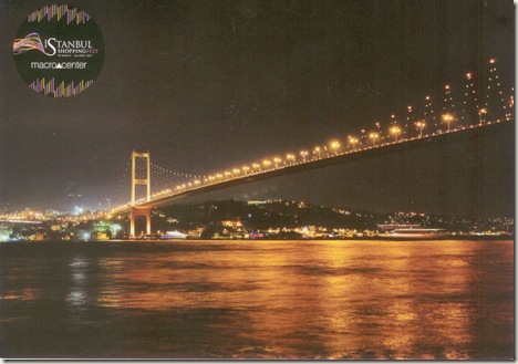
On postcard: Bosphorus Bridge

The Bosphorus Bridge, also called the First Bosphorus Bridge (Turkish: Boğaziçi Köprüsü or 1. Boğaziçi Köprüsü) is one of the two bridges in Istanbul, Turkey, spanning the Bosphorus strait (Turkish: Boğaziçi) and thus connecting Europe and Asia (the other one is theFatih Sultan Mehmet Bridge, which is called the Second Bosphorus Bridge.) The bridge is located between Ortaköy (on the European side) and Beylerbeyi (on the Asian side). It is a gravity anchored suspension bridge with steel pylons and inclined hangers. Theaerodynamic deck is hanging on zigzag steel cables. It is 1,510 m (4,954 ft) long with a deck width of 39 m (128 ft). The distance between the towers (main span) is 1,074 m (3,524 ft) and their height over road level is 105 m (344 ft). The clearance of the bridge from sea level is 64 m (210 ft). The Bosphorus Bridge had the 4th longest suspension bridge span in the world when it was completed in 1973, and the longest outside the United States. At present, it is the 16th longest suspension bridge span in the world.

History

Since April 2007, a fully computerized LED lighting system of changing colours and patterns, developed by Philips, illuminates the bridge at night.

The idea of a bridge crossing the Bosphorus dates back to antiquity. For Emperor Darius I The Great of Persia (522 BC - 485 BC), as recorded by the Greek writer Herodotus in his Histories, Mandrocles of Samos once engineered a pontoon bridge that stretched across the Bosphorus, linking Asia to Europe, so that Darius could pursue the fleeingScythians as well as move his army into position in the Balkans to overwhelmMacedon. The first project for a permanent bridge across the Bosphorus was proposed to Ottoman Sultan Abdul Hamid II by the Bosphorus Railroad Company in 1900, which included a rail link between the continents.

The decision to build a bridge across the Bosphorus was taken in 1957 by Prime Minister Adnan Menderes. For the structural engineering work, a contract was signed with the British firm Freeman Fox & Partners in 1968. The bridge was designed by the renowned British civil engineers Sir Gilbert Roberts and William Brownwho also designed the Humber Bridge, Severn Bridge, Forth Road Bridge, Auckland Harbour Bridge and the Volta River Bridge. The construction started in February 1970, the ceremonies were attended by President Cevdet Sunay and Prime Minister Süleyman Demirel. The construction was carried out by the Turkish firm Enka Construction & Industry Co.along with the co-contractors Cleveland Bridge & Engineering Co. Ltd. (England) and Hochtief AG (Germany). Thirty-five engineers and 400 men worked on the project.

The bridge was completed on 30 October 1973, one day after the 50th anniversary of the founding of the Republic of Turkey, and opened by President Fahri Korutürk and Prime MinisterNaim Talu. The cost of the bridge amounted to USD 200 million.

At the time the bridge was opened, much was made of its being the first bridge between Europe and Asia since the pontoon bridge of Xerxes in 480 BCE. That bridge, however, spanned the Hellespont (Dardanelles), some distance away from the Bosphorus.

Transportation

The highway bridge has a total width of eight lanes. Each direction has three lanes for vehicular traffic plus one emergency lane and onesidewalk. On weekday mornings, commuter traffic flows mostly westbound to the European part, so four of the six lanes run westbound and only two eastbound. Conversely, on weekday evenings, four lanes are dedicated to eastbound traffic and two lanes only to westbound.

In the first four years, pedestrians could walk over the bridge, reaching it with elevators inside the towers on both sides. No pedestrians or commercial vehicles like trucks are allowed to use the bridge today.

Nowadays, around 180,000 vehicles pass daily in both directions, almost 85% being automobiles. On 29 December 1997, the one-billionth vehicle passed the bridge. Fully loaded, the bridge sags about 90 cm (35 in) in the middle of the span.

The Bosphorus Bridge is a toll bridge, and a toll plaza with 13 toll booths is situated near the bridge on the Asian side. A toll is charged for passing from Europe to Asia, but not for passing in the reverse direction. Since 1999, some of the toll booths (#9 - #13), located to the far left as motorists approach them, are unmanned and equipped only with a remote payment system (Turkish: OGS) in order to speed up traffic. In addition to OGS, another toll pay system with special magnetic cards (Turkish: KGS) was put in service for use at specific toll booths in 2005. Since April 3, 2006, toll booths accept only KGS and OGS. In 2006 the toll was 3.00 YTL or about $2.00.

Since April 2007, a fully computerized LED lighting system of changing colours and patterns, developed by Philips, illuminates the bridge at night.

Other uses

Daytime view of the bridge.

The Intercontinental Istanbul Eurasia Marathon, organized annually in October, starts from theAnatolian part of Istanbul, crosses the Bosphorus on the bridge and ends in the European part during which the bridge is closed to the vehicular traffic.

Visitors to Istanbul in October can sign up for the 'fun run' at many points round the city and take the opportunity to cross the bridge by foot - many take picnics to enjoy the view.

The bridge was depicted on the reverse of the Turkish 1000 lira banknotes of 1978-1986.

On 15 May 2005 at 7.00 a.m. local time, U.S. tennis star Venus Williams played a show game with Turkish standout İpek Şenoğlu on the bridge, the first tennis match ever to be played on two continents. The event was organized as a promotion ahead of the 2005 WTAIstanbul Cup and lasted five minutes. After the exhibition, they both threw a tennis ball into the Bosphorus.

On 17 July 2005 at 10.30 a.m. local time, British Formula One driver David Coulthard drove his Red Bull racing car on the bridge first from the European side to the Asian side, and then turning with a spectacular powerslide at the toll plaza back to the European side for show. He parked his car in the garden of Dolmabahçe Palace where his ride had started. While crossing the bridge with his Formula 1 car, Coulthard was picked up by the automatic surveillance system and charged with a fine of 20 Euros because he passed through the toll booths without payment. His team accepted to pay for him.

otkr4